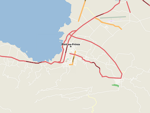
 Before
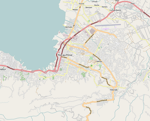 After 2 Weeks
We were all struck by the magnitude of the crisis in Haiti. What most people didn't realize was how difficult the rescue, recovery, and rebuilding process became when adequate maps didn't exist for emergency workers.
Before the earthquake, digital maps of Haiti showed very few street names, buildings, or points of interest. Dedicated volunteers from the open-source mapping community spent two weeks analyzing satellite imagery to build a detailed, life-saving street grid used directly by international first responders.