Birthplaces and Key Locations
From a geographical perspective, the life of Jesus unfolded across a remarkably diverse landscape within the Levant region during the early Roman Empire. According to historical and biblical accounts, Jesus was born in Bethlehem, a small agricultural village situated in the rocky hills of Judea, roughly 5 miles south of Jerusalem. However, he spent the vast majority of his life and ministry growing up and traveling around Nazareth, a secluded hillside hamlet located in the lower region of Galilee.
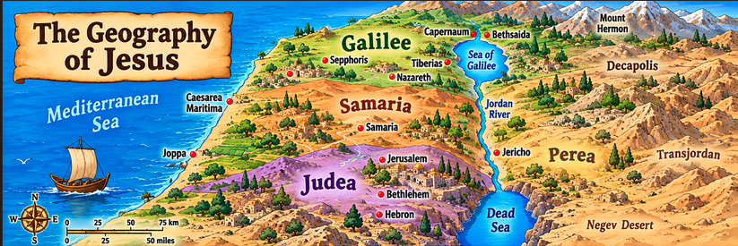
Key regions frequently referenced in historical studies of this era include:
- Galilee: A fertile, rolling mountainous region in the north characterized by abundant rainfall, agricultural valleys, and the large freshwater Sea of Galilee.
- Samaria: The central highland territory situated directly between Galilee and Judea, populated largely by a distinct cultural and religious community.
- Judea: The rugged, arid southern territory centered around the major political and religious capital of Jerusalem.
- Perea: The region located east of the Jordan River valley, characterized by deep gorges and agricultural plateau lands.
Geology and Terrain
The topography of first-century Palestine is defined by extreme vertical shifts packed into a relatively small geographic area. The landscape runs on a north-south axis consisting of distinct parallel zones:
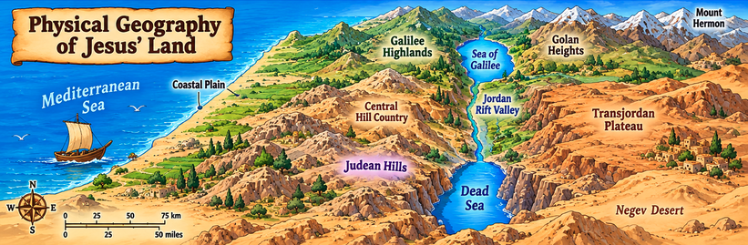
- The Coastal Plain: A flat, sandy strip bordering the Mediterranean Sea, historically used for major transit and farming.
- The Central Mountain Range: A rugged backbone of limestone hills and ridges (including the mountains of Judea and Samaria) filled with natural caves, rocky soil, and terraced farming slopes.
- The Jordan Rift Valley: A dramatic geological depression plunging far below sea level, carved out by the Jordan River as it flows from the Sea of Galilee down into the hyper-saline Dead Sea.
- The Transjordan Plateau: A high, rolling tableland rising sharply on the eastern side of the rift valley.
Countries and Political Powers
In geopolitical terms, there was no independent country called "Palestine" or "Israel" during the early first century. Instead, the region was entirely under the control or oversight of the Roman Empire. Following the death of Herod the Great around 4 BCE, the territory was partitioned by Rome into different administrative zones:
- Client Kingdoms / Tetrarchies: Galilee and Perea were ruled locally by Herod Antipas as a tetrarch (a lesser Roman governor). Other northern regions were governed by fellow heirs of the Herodian dynasty.
- Roman Provinces: Judea, Samaria, and Idumea were placed under direct Roman rule, administered locally by a Roman prefect or procurator (such as Pontius Pilate) stationed in the coastal city of Caesarea Maritima, while religious governance in Jerusalem was managed by the Jewish high priesthood.
Population and Demographics
Demographic estimates for first-century Palestine suggest a total population ranging roughly between 500,000 and 1 million people across all regions combined.
- Urban vs. Rural: The vast majority of the population lived in small, tight-knit agrarian villages rather than sprawling cities. Nazareth was a tiny hamlet holding likely no more than 400 to 500 residents. In contrast, major administrative cities like Sepphoris or Tiberias in Galilee, and Jerusalem in Judea, concentrated thousands of residents, artisans, and political elites.
- Tribal and Cultural Groups: The region was populated primarily by Jewish communities in Judea and Galilee, alongside distinct populations of Samaritans, Hellenized Greek-speaking city dwellers, and Roman military personnel and administrators.
Climate and Weather
The climate of the region is Mediterranean, characterized by two distinct seasonal patterns that deeply influenced ancient agriculture and travel:
- The Wet Season (November to April): Often called "winter" or the season of the "early and latter rains," this period brought cool temperatures and most of the region's annual precipitation, occasionally producing flash floods in the desert wadis (dry riverbeds).
- The Dry Season (May to October): A long, hot, rainless summer marked by intense sunshine, dry winds blowing from the desert, and reliance on collected cistern water, deep wells, and morning dew for crops like olives, grapes, and grains.
Transportation and Travel
Movement across this rugged terrain relied heavily on an ancient network of footpaths, animal tracks, and newly engineered Roman roads:
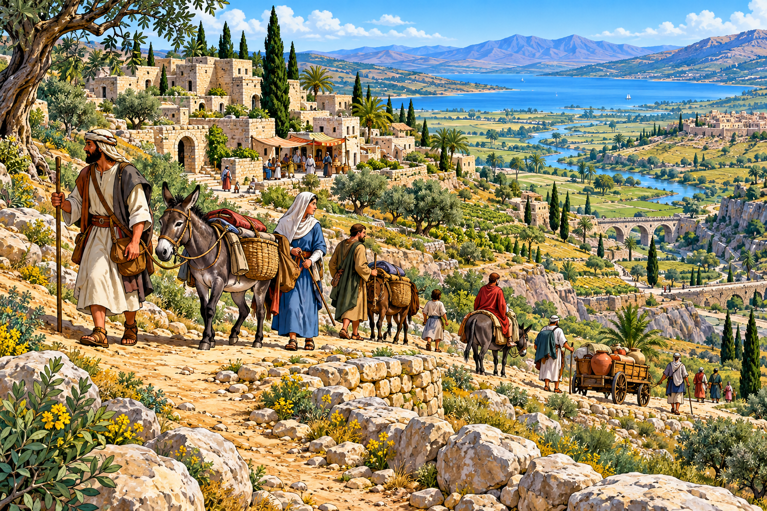
- Walking and Pack Animals: Most common people traveled entirely on foot, sometimes aided by donkeys or mules for carrying goods. A journey from Nazareth down to Jerusalem (roughly 80 miles straight line, further by winding paths) would take a traveler about three to four days of steady walking through the central hills.
- Major Trade Routes: The famous Via Maris ("Way of the Sea") ran along the coastal plain connecting major empires to the north and south, while interior routes linked regional hubs like Galilee to Jerusalem, making travel vulnerable to steep climbs, banditry, and intense seasonal heat.